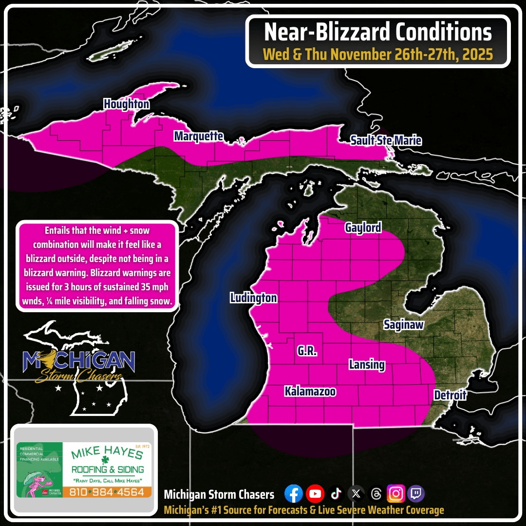
With the combination of snow and higher wind gusts, we are closely monitoring for the potential for either near-blizzard conditions, and ground blizzard conditions over the next couple of days. What does this terminology mean? Let us sum it up.
Some will argue that it's close enough, and a blizzard warning should be issued, and in the world of a human's natural response, we'd agree. However, criteria is needed for a blizzard warning to be met. Blizzard warnings use the following criteria:
- Sustained 35 mph winds over 3 consecutive hours or more
- Visibilities under 1/4 of a mile over 3 consecutive hours or more
- Snow expected to be falling in some capacity
Wednesday and Thursday, visibilities sustained under a quarter of a mile for longer periods seems likely, but the sustained wind speed is modeled to be on average between 20-30 mph. Sustained wind speed is different then wind gusts, which are a one-time measurement over a couple minutes to an hour. Because we are jusssssst below the criteria right now, we can use the wording "near-blizzard conditions". Now a ground blizzard is more unique. These occur when you have the sustained winds over 35 mph and 1/4 of a mile visibilities, but no falling snow. So, this term is used when a system or lake effect event is over, but the winds increase significantly to blizzard criteria, resulting in all that fallen snow now blowing around within the first 5-10 feet off the ground. Because the snow and wind will exist nearly at the same time with this event through Thanksgiving, we are more inclined to use the term "near blizzard conditions" for now. If winds continue at a good clip into our break on Friday, then "ground blizzard" will need to be considered.
Hopefully you learned something new today! Yes, even our areas where minimal snowfall is expected (less than 2"), you can still get near-blizzard conditions, which is why we highlighted areas all the way inland towards southeast Michigan. |


0 Comments
Join the conversation
Be the first to comment
Share your thoughts above.